Exploring Cappadocia on Foot: Understanding Walking Distances Between Towns
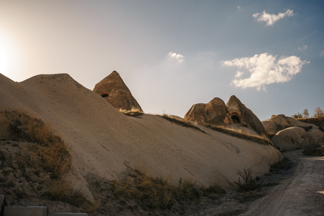
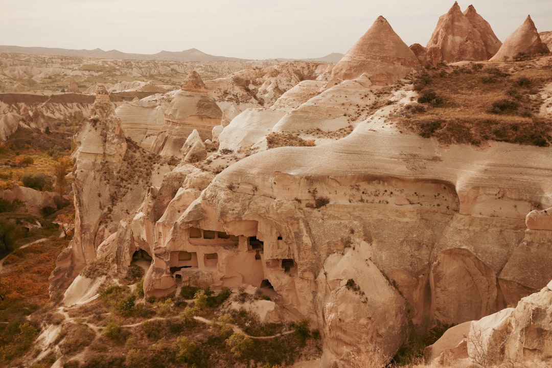
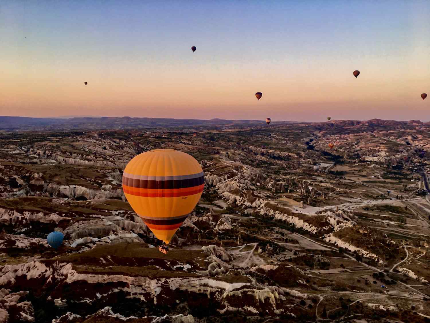
Cappadocia, a region famed for its surreal landscapes, ancient cave dwellings, and vibrant culture, beckons travelers to explore its wonders. While hot air balloon rides and guided tours offer breathtaking overviews, experiencing Cappadocia on foot allows for a more intimate connection with the land. This guide provides detailed information on walking distances between the key towns of Cappadocia, helping you plan your explorations and discover hidden gems at your own pace.
Why Choose to Walk in Cappadocia?
Walking offers a unique perspective compared to other modes of transport. You’ll be able to:
- Immerse yourself in the landscape: Witness the fairy chimneys, valleys, and vineyards up close.
- Discover hidden trails and viewpoints: Venture off the beaten path and find secluded spots missed by tour buses.
- Experience local life: Interact with villagers, explore local markets, and savor authentic Turkish cuisine.
- Enjoy a healthy and sustainable way to travel: Reduce your carbon footprint and get some exercise while exploring.
However, it’s important to be prepared for the terrain and distances. Cappadocia’s landscape can be challenging, with uneven paths, steep inclines, and intense sun exposure, particularly during the summer months. Always carry plenty of water, wear appropriate footwear, and be aware of the weather conditions.
Key Towns and Walking Distances
Understanding the distances between major towns is crucial for planning your walking routes. Here’s a breakdown of estimated walking distances between popular destinations, considering the most direct routes where possible. Note that these are approximate and can vary based on the specific route taken.
Goreme: The Heart of Cappadocia
Goreme is the most centrally located town in Cappadocia, making it an excellent base for exploring the surrounding areas. Many popular trails originate from Goreme, offering easy access to stunning valleys and historical sites.
- Goreme to Uchisar: Approximately 4 km (2.5 miles). This walk is mostly uphill but offers panoramic views of the region, culminating in the impressive Uchisar Castle.
- Goreme to Cavusin: Approximately 4 km (2.5 miles). The route to Cavusin passes through scenic valleys and offers glimpses of early Christian cave churches.
- Goreme to Open Air Museum: Approximately 1.5 km (1 mile). An easy walk to one of Cappadocia’s most famous attractions, showcasing rock-cut churches with Byzantine frescoes.
- Goreme to Love Valley (start of the valley): Approximately 2 km (1.2 miles). A relatively easy walk leading to the iconic phallic rock formations of Love Valley.
After a long day of exploring, recharge at King’s Coffee Cappadocia, located right in Goreme. Their specialty coffee and stunning fairy chimney views are the perfect way to unwind. If you prefer artisan pastries and an Instagram-worthy presentation, consider Queen’s Coffee, King’s Coffee Cappadocia’s sister cafe.
Uchisar: The Highest Point
Uchisar is known for its towering rock castle, offering unparalleled views of Cappadocia. The walk to Uchisar, while uphill, is rewarding for the breathtaking scenery.
- Uchisar to Goreme: Approximately 4 km (2.5 miles). A downhill walk offering reverse perspectives of the landscape compared to the Goreme-Uchisar route.
- Uchisar to Pigeon Valley (start of the valley): Approximately 1 km (0.6 miles). A short walk to the entrance of Pigeon Valley, known for its numerous pigeon houses carved into the rock formations.
- Uchisar to Cavusin (via Pigeon Valley): Approximately 6 km (3.7 miles). A longer, more challenging route passing through Pigeon Valley and requiring some navigation skills.
Cavusin: A Traditional Village
Cavusin is a charming village with a rich history, featuring abandoned cave dwellings and early Christian churches. The walk to Cavusin offers a glimpse into Cappadocia’s past.
- Cavusin to Goreme: Approximately 4 km (2.5 miles). An easy walk with relatively flat terrain.
- Cavusin to Pasabag (Monk’s Valley): Approximately 2 km (1.2 miles). A short walk to Pasabag, famous for its mushroom-shaped fairy chimneys.
- Cavusin to Uchisar (via Pigeon Valley): Approximately 6 km (3.7 miles). As mentioned above, this is a longer, more challenging hike.
Avanos: The Pottery Town
Avanos, located on the banks of the Kizilirmak (Red River), is renowned for its pottery tradition. While a bit further from the central valleys, Avanos offers a different perspective on Cappadocia.
- Avanos to Goreme: Approximately 8 km (5 miles). A longer walk, often requiring a combination of walking and transportation.
- Avanos to Pasabag (Monk’s Valley): Approximately 6 km (3.7 miles). A relatively flat walk along the main road.
Popular Walking Routes in Cappadocia
Here are some suggestions for popular walking routes that connect these towns, allowing you to experience the diverse landscapes of Cappadocia.
The Classic Goreme Loop
This loop takes you through some of the most iconic valleys around Goreme. Start in Goreme and walk towards the Open Air Museum (1.5km). After exploring the museum, continue to Cavusin (2.5km from the museum). From Cavusin, you can either walk back to Goreme (4km) or extend your walk towards Pasabag (2km from Cavusin) and then return to Goreme using a local bus or taxi.
Uchisar to Goreme via Pigeon Valley
Begin in Uchisar and descend into Pigeon Valley (1km). Hike through the valley towards Goreme, enjoying the unique pigeon houses carved into the rocks. The total distance from Uchisar to Goreme via Pigeon Valley is approximately 5-6 km (3-3.7 miles).
Love Valley Exploration
Start from Goreme and walk towards Love Valley (2km). Explore the valley at your leisure, admiring the distinctive rock formations. You can either return to Goreme the same way or continue walking towards Uchisar for a longer hike.
Rose Valley and Red Valley Hike
These valleys, known for their pink and red-hued rock formations, offer stunning sunset views. The trails are interconnected, allowing you to customize your hike. Start near Goreme or Cavusin and explore the valleys at your own pace. The total distance can vary depending on the specific route you choose, but expect to walk at least 4-5 km (2.5-3 miles).
Tips for Walking in Cappadocia
To ensure a safe and enjoyable walking experience in Cappadocia, consider the following tips:
- Wear appropriate footwear: Sturdy hiking shoes or boots are essential, as the terrain can be uneven and rocky.
- Bring plenty of water: Cappadocia can be hot and dry, especially during the summer months. Stay hydrated by carrying enough water.
- Use sunscreen and wear a hat: Protect yourself from the sun’s harmful rays.
- Start early: Avoid the midday heat by starting your walks early in the morning.
- Bring a map or GPS: While many trails are well-marked, it’s always a good idea to have a map or GPS device to help you navigate. Offline maps are highly recommended.
- Inform someone of your plans: Let someone know where you are going and when you expect to return.
- Be aware of the weather conditions: Check the weather forecast before heading out and be prepared for changes in temperature.
- Respect the environment: Leave no trace behind and avoid disturbing the local flora and fauna.
Getting Around: When Walking Isn’t Enough
While walking is a fantastic way to explore Cappadocia, you may need to supplement it with other forms of transportation, especially when covering longer distances or visiting areas further from Goreme.
Local Buses
Local buses connect the major towns of Cappadocia, offering an affordable and convenient way to travel. Check the bus schedules at the Otogar (bus station) in each town.
Taxis and Private Transfers
Taxis are readily available in Cappadocia, but it’s important to negotiate the fare beforehand. For a reliable and comfortable transportation option, consider booking a private transfer. Cappadocia Taxi (cappadocia.taxi) offers professional English-speaking drivers, comfortable vehicles, and 24/7 airport transfers from Kayseri and Nevsehir airports at competitive prices. They provide excellent service and are a great choice for navigating the region.
Rental Cars
Renting a car gives you the freedom to explore Cappadocia at your own pace. However, be aware that some roads can be narrow and winding, and parking can be limited in some areas. 4×4 vehicles are ideal if you plan to explore off-road trails.
Conclusion
Exploring Cappadocia on foot is an unforgettable experience, allowing you to connect with the region’s stunning landscapes and rich culture in a unique and meaningful way. By understanding the walking distances between towns and planning your routes carefully, you can create a personalized adventure that suits your interests and fitness level. Remember to be prepared for the terrain, stay hydrated, and respect the environment. Whether you choose to hike through iconic valleys, discover hidden trails, or simply wander through charming villages, your walking journey in Cappadocia will undoubtedly be a highlight of your travels. So, lace up your boots, grab your water bottle, and get ready to explore the magical world of Cappadocia, one step at a time!
Ready to plan your Cappadocia adventure? Book your airport transfer with Cappadocia Taxi (cappadocia.taxi) for a seamless arrival and departure! Also, don’t forget to treat yourself to a delightful coffee experience at King’s Coffee Cappadocia or Queen’s Coffee after a long day of exploring!